

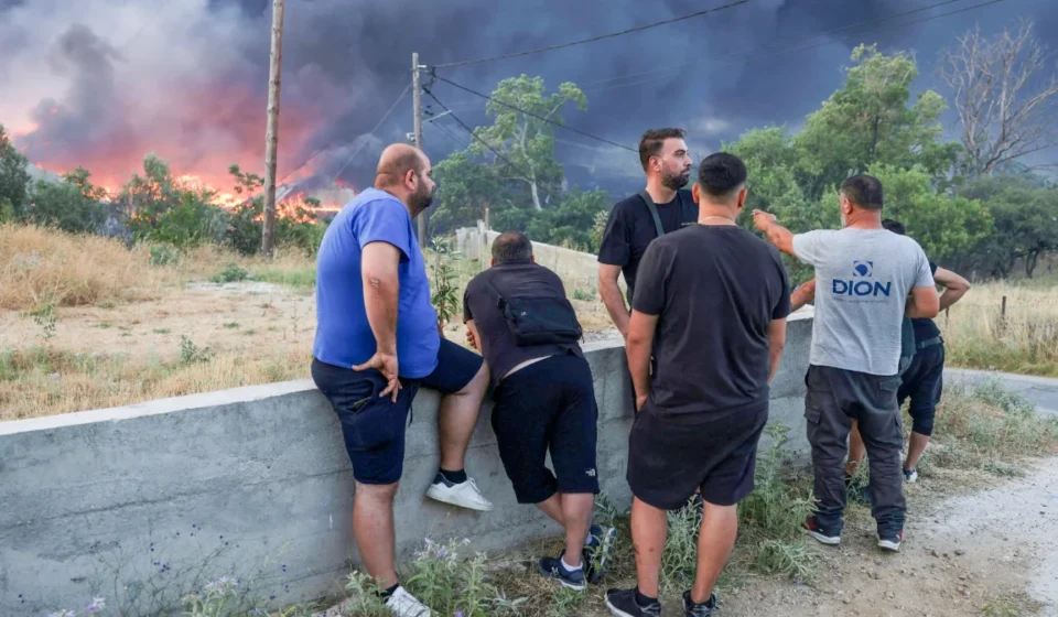

Greece is taking a bold step to confront one of its most persistent natural threats by deploying advanced thermal imaging satellites designed to detect wildfire hotspots and forecast how flames could spread across forests before they become uncontrollable. The initiative, announced on July 17, 2026, comes as soaring temperatures, prolonged dry conditions, and stronger seasonal winds raise fears of another destructive fire season across the Mediterranean nation.
For communities that have endured years of devastating wildfires, every minute matters. A fire that begins as a small spark in remote woodland can grow into a fast moving disaster within hours. Greek officials believe combining satellite observations with predictive computer models could provide firefighters with the precious time needed to position crews, protect homes, and organize evacuations before flames reach populated areas.
Why Greece Is Investing in Space Based Fire Detection
Wildfires have become an increasingly difficult challenge throughout southern Europe. Rising summer temperatures and extended periods without rainfall have left forests, hillsides, and rural landscapes highly vulnerable. Greece has experienced several severe fire seasons during the past decade, with thousands of hectares of woodland destroyed and numerous communities forced to evacuate.
The newly deployed satellite system uses sophisticated thermal sensors capable of identifying unusual heat signatures across large stretches of land. Rather than waiting for smoke to become visible or emergency calls to reach authorities, officials hope the technology can recognize developing fire conditions much earlier.
Once a potential hotspot is identified, advanced simulation software estimates how the fire may behave over the coming hours. These projections consider environmental conditions such as vegetation density, local terrain, humidity, wind speed, and air temperature. Emergency planners can then use these forecasts to determine where firefighting aircraft, ground crews, and emergency vehicles should be deployed first.
Predicting the Direction of Dangerous Flames
One of the most valuable aspects of the new system is its ability to estimate wildfire movement before flames spread across large areas. Fire behavior depends on many changing factors, making traditional forecasting difficult. By continuously updating satellite observations and feeding them into predictive models, authorities can build a clearer picture of where danger is increasing.
Emergency managers can compare several possible scenarios rather than relying on a single prediction. If weather conditions suddenly shift, new simulations can quickly provide revised forecasts, allowing firefighters to adapt their strategy in real time.
This capability is especially important in mountainous regions where steep slopes and changing wind patterns can rapidly accelerate fire growth. Earlier awareness may help emergency services protect vulnerable villages and critical infrastructure before evacuation routes become unsafe.
Technology Supports Firefighters Rather Than Replacing Them
Despite impressive advances in remote sensing and artificial intelligence, experts stress that satellite technology serves as a decision support tool rather than a replacement for experienced firefighters.
Local crews continue to provide essential observations from the ground. Helicopters and aircraft still perform water drops where conditions allow. Incident commanders remain responsible for making tactical decisions based on changing circumstances.
The satellite network simply gives those professionals a broader and faster understanding of developing threats.
- Earlier detection of emerging hotspots.
- Faster identification of remote fires that may otherwise go unnoticed.
- Improved forecasting of likely fire movement.
- Better coordination of emergency resources across multiple regions.
- Additional support for evacuation planning.
The combination of experienced personnel and advanced monitoring tools represents a growing trend in disaster management across Europe.
Extreme Heat Continues to Raise the Stakes
The deployment comes during another exceptionally hot Mediterranean summer. Heatwaves increase the likelihood that dry vegetation will ignite while also creating conditions that allow fires to spread with alarming speed.
Scientists have repeatedly warned that hotter summers increase wildfire risk in many parts of southern Europe. Even small ignition sources can become major incidents when forests remain dry for extended periods.
Public awareness campaigns continue to remind residents and visitors to avoid activities that could accidentally start fires during periods of extreme heat. Carelessly discarded cigarettes, unattended outdoor cooking equipment, and sparks from machinery remain among the common causes of wildfire outbreaks.
Readers seeking additional information about wildfire science and prevention can explore educational resources provided by the National Aeronautics and Space Administration, which explains how satellite observations assist environmental monitoring around the world.
Satellite Monitoring Is Becoming a Global Strategy
Greece is not alone in expanding the use of satellite technology for environmental protection. Governments across Europe, North America, Australia, and other fire prone regions increasingly rely on Earth observation systems to monitor forests, measure vegetation health, and identify dangerous heat patterns.
Modern satellites can capture detailed thermal information both during daylight and at night, allowing authorities to maintain continuous surveillance across vast landscapes that would otherwise require enormous numbers of ground patrols.
International cooperation has also become an important part of wildfire management. Shared satellite data enables neighboring countries to monitor regional fire activity, especially when smoke crosses borders or emergency assistance is required.
The European Space Agency Earth Observation program offers extensive information about satellite monitoring that supports disaster response, environmental protection, and climate research throughout Europe.
Communities Hope Early Warnings Will Save Lives
For residents living near forests, technology alone cannot erase the emotional scars left by previous fire seasons. Many families remember hurried evacuations, smoke filled skies, and anxious nights waiting for news about their homes.
Earlier warnings may provide valuable extra time for families to leave safely, emergency workers to establish defensive lines, and authorities to protect schools, hospitals, and transportation routes.
Municipal leaders also expect better forecasts to improve communication with the public. Instead of reacting only after flames become visible, officials could issue more informed guidance based on projected fire movement.
Challenges Still Remain
Even the most advanced satellite systems have limitations. Cloud cover, rapidly changing weather, and multiple simultaneous fires can complicate emergency response. Predictive models continue to improve, but wildfire behavior remains influenced by countless variables that cannot always be anticipated with complete accuracy.
Authorities must also ensure that satellite information reaches local responders quickly enough to influence operational decisions. Investment in communications infrastructure, trained analysts, and coordination centers remains just as important as the technology itself.
Long term wildfire resilience also depends on forest management, public education, responsible land use, and continued investment in emergency preparedness.
A New Chapter in Greece’s Fight Against Wildfires
The deployment of heat seeking thermal imaging satellites marks another milestone in Greece’s effort to confront increasingly dangerous wildfire seasons. By combining real time space based observations with predictive fire simulations, emergency services hope to shift from reacting after disasters begin toward anticipating where they may strike next.
While no technology can completely eliminate the threat posed by extreme heat and powerful forest fires, earlier detection and smarter forecasting offer meaningful opportunities to reduce damage, protect firefighters, and save lives. As climate conditions continue placing greater pressure on landscapes across southern Europe, innovations that strengthen preparedness may become just as valuable as the aircraft, engines, and emergency crews working tirelessly on the ground.